Missing and inconsistent measuring values are detected immediately.
Leave the excavation or construction site with a finished plan.
Rework at the office is reduced to a minimum.
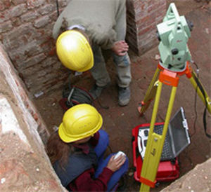
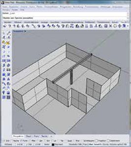
TachyCAD is a system solution for the CAD supported inventory data collection. The measurement results of different common surveying instruments will directly be converted into geometry. According to the requirements, floor plans, sections and views or 3D objects will directly be generated as AutoCAD drawing on site.
The Tachymeter turns into a mouse pointer
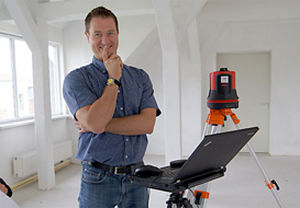
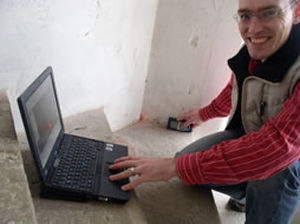
With TachyCAD it is possible to transfer measurement data wireless from a tachymeter to a notebook. When triggering a measurement the measurement data will automatically be transferred to the notebook. With these data TachyCAD calculates the 3D coordinates of the measuring point. It will immediately be available for drawing and constructing in AutoCAD, just as if you had clicked with the mouse or had entered the data manually. Also, distances, measured by Bluetooth capable laser distance meters, will be transferred wireless to AutoCAD.
Optimised operating cycles in detail
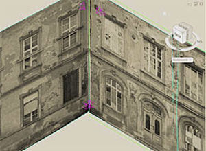
An extensive range of commands, especially for the archaeological excavation documentation amends the AutoCAD functionality. The basic principle of all commands is always to generate finished illustrations by using as few entries and measurements as possible.